Although Dugdale's personal life is not excessively documented, his work as an antiquarian topographical and cartographic publisher is frequently encountered. The early to mid nineteenth century was certainly blessed with a number of talented mapmakers and engravers, as well as some very astute publishers, who knew the markets and the requirements of the map and book-buying public of the time.
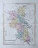
Thomas Dugdale's is perhaps best known for his finely detailed small and finely detailed county maps, published in 1835 in his volume Curiosities of Great Britain, with which he was assisted by civil engineer, William Burnett. On the success of Curiosities, Dugdale went on to a much greater project: eventually published in 1846, a magnificent set of eleven volumes under the title: England and Wales Delineated. The work was very much a team effort: the full set of county maps being by Joshua Archer, engraved by Neele and Roper (amongst others) and organised by Dugdale alphabetically. They contain a huge amount of factual and graphic information including: the 'hundreds' (ancient divisions within a county), market towns, manors, polling places, roads, rivers, canals, mail coach routes and the first few railways, actual and planned.
These fine county maps were interspersed with a wealth of other engravings, around three hundred in all, of monuments, historical buildings, views and town plans. These remarkable plates appear quite frequently and are often cited as some of the more surprisingly accurate and interesting of the time.
